



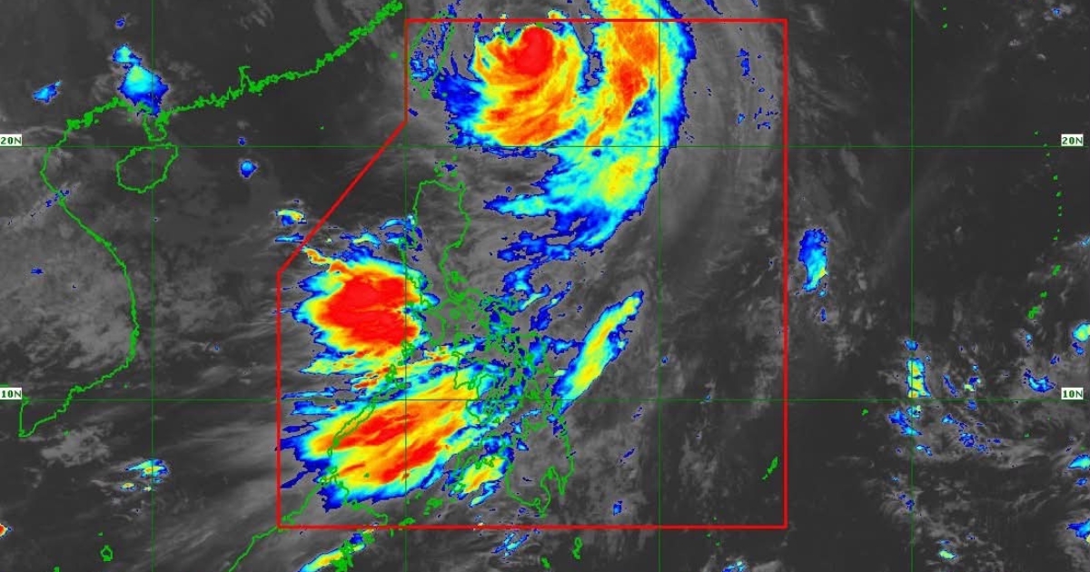
Typhoon Inday (international name: Bavi) is now approaching the Sakishima Islands in southern Japan and is expected to exit the Philippine Area of Responsibility (PAR) on Saturday morning, July 11, according to the Philippine Atmospheric, Geophysical and Astronomical Services Administration (PAGASA).
In its 5 a.m. tropical cyclone bulletin, PAGASA said the center of Typhoon Inday was estimated at 500 kilometers northeast of Itbayat, Batanes, packing maximum sustained winds of 140 km/h, gusts of up to 170 km/h, and moving northwestward at 20 km/h.
Wind Signals Remain Over Northern Luzon
Tropical Cyclone Wind Signal (TCWS) No. 2 remains in effect over the northern portion of Batanes, particularly Itbayat, where gale-force winds pose a minor to moderate threat to life and property.
Meanwhile, TCWS No. 1 is hoisted over the rest of Batanes, the Babuyan Islands, and the northern municipalities of mainland Cagayan, including Santa Ana, Gonzaga, Santa Teresita, Buguey, Camalaniugan, Aparri, Ballesteros, Abulug, Pamplona, Sanchez-Mira, Claveria, and Santa Praxedes.
Habagat Continues to Bring Strong Winds and Rain
Although Inday is moving away from the country, PAGASA said the typhoon will continue to enhance the Southwest Monsoon (Habagat), bringing strong to gale-force wind gusts across most parts of the Philippines.
Heavy rainfall associated with the enhanced Habagat is expected over several areas. Residents are advised to monitor the latest weather advisories and warnings issued by PAGASA and local authorities.
Dangerous Sea Conditions Persist
A Gale Warning remains in effect over the northern and eastern seaboards of Northern Luzon.
Very rough to high seas, with waves reaching up to 7 meters, are forecast over the northern and eastern seaboards of Batanes, while rough seas are expected in several coastal areas of Luzon, Visayas, and parts of Mindanao.
PAGASA warned that sea travel remains risky, especially for small vessels and motorbancas. Mariners are advised to remain in port or seek safe harbor until conditions improve.
Forecast Track
PAGASA said Inday is expected to continue moving northwestward, pass close to or make landfall over the Sakishima Islands in southern Japan, and exit PAR on Saturday morning. The typhoon is then forecast to cross the East China Sea before making landfall along the eastern coast of mainland China.
The weather bureau expects Inday to maintain typhoon strength over the next 12 hours before weakening into a severe tropical storm as it moves farther inland over China.
Authorities continue to urge residents in areas prone to flooding, landslides, and strong winds to remain vigilant and follow evacuation orders and other safety instructions issued by local government units and disaster management officials.















Comments